Dr. Courtney Di Vittorio Receives a Pilot Grant to Develop Novel Bio‐Optical and Lake Hydrodynamic Modeling Approaches to Monitor Water Quality
(Author: Yassmin Shaltout)
 As a Civil Engineer and Water Resource Management Specialist, Dr. Courtney Di Vittorio has a natural passion for using satellite imagery to understand the quantity and quality of water. From her work in international development, she is also cognizant of the importance of access to clean water and irrigation resources in the pursuit of escaping poverty. Water is a life-line for most living organisms and its quantity and quality are of growing importance as well as concern, thus, dedicating one’s work to the complexity of water takes long term dedication and patience. The entanglement of this matter requires the development of collaborative research like Dr. Di Vittorio’s project which is partnering with the Yadkin Riverkeeper for data collection and the North Carolina Department of Environmental Quality for model development. In addition to various community partners, this project is highly representative of academic collaboration – specifically, the outcomes of this research will enable colleagues to further advance their work in water management leading to overall improved water monitoring. Dr. Di Vittorio’s ability to develop an economical lake-water quality monitoring system through this study will collaboratively enhance Dr. Kyana Young’s environmental engineering measurement of nutrient treatment technologies while also aiding Dr. Chris Zarzar’s hydro-meteorology development of new stochastic modeling and calibration procedures. The uniqueness in Dr. Di Vittorio’s work lies in the usage of unmanned aerial systems and satellite data to develop a more comprehensive and cost-effective water quality monitoring system. This holistic and feasible approach will be applied at High Rock Lake where local animal operations have undermined the lake’s water quality, however, these innovative methods will also be ready to create an impact on the water quality of lakes worldwide following further development of the system which will be allowed by the acquisition of this Pilot Grant.
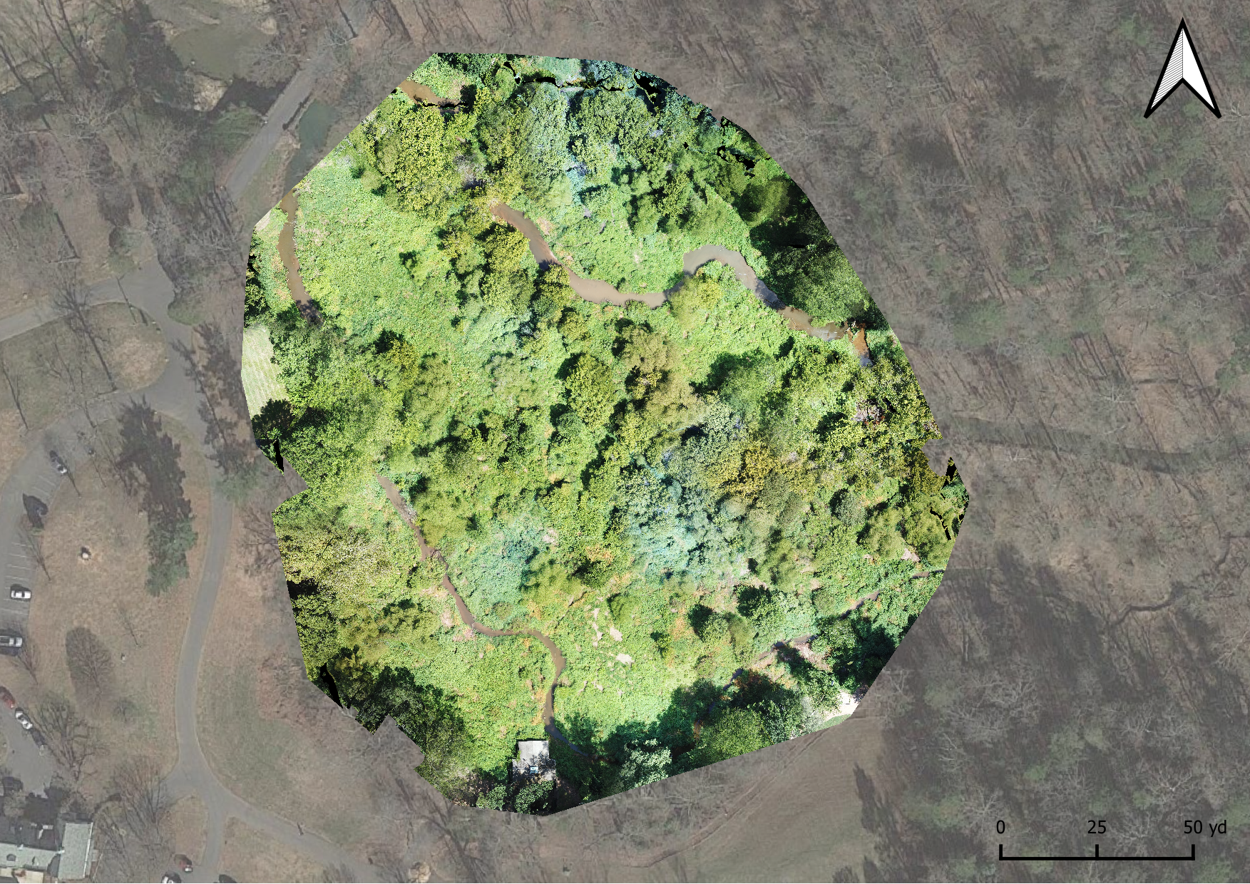
An orthomosaic of Lake Katharine collected from a drone to test initial field data collection methods.